
Bus route 292 in London links “RC Church” and “Colindale Superstores”.
Which way bus 292 runs
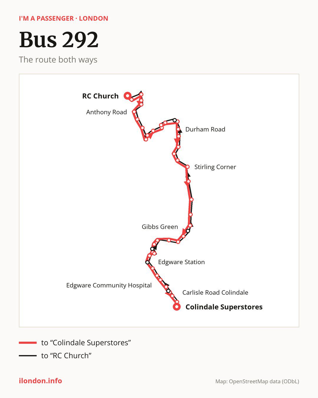
From “RC Church” to “Colindale Superstores”: 42 stops. On the way: “Cromwell Road”, “Torworth Road”, “Leeming Road”, “Catterick Way”, “Anthony Road”, “Croxdale Road”, “Stratfield Road”, “Elstree & Borehamwood Railway Station”, “Glenhaven Avenue”, “Furzehill Road”. Then “Tesco”, “Elstree Studios”, “Civic Offices”, “Elstree Way”, “Durham Road”, “Kenilworth House”, “Ripon Park”, “Cleveland Crescent”, “Ashley Drive”, “Stirling Corner”. Then “Scratchwood Open Space”, “Moat Mount Open Space”, “The Fairway Mill Hill”, “Apex Corner”, “Gibbs Green”, “Cloister Gardens”, “Farm Road”, “Broadfields Avenue Edgware”, “Edgware Library”, “Edgware Station”. Before “Colindale Superstores”: “Edgware Bus Station”, “Manor Park Crescent”, “Whitchurch Lane”, “Deansbrook Road”, “Edgware Community Hospital”, “North Road (HA8)”, “Burnt Oak Broadway”, “Watling Avenue Burnt Oak”, “Montrose Avenue / Unitas Youth Zone”, “Carlisle Road Colindale”.
The return journey is different. Towards “RC Church”: 42 stops. Only in this direction does it call at “Stag Lane (HA8)”, “Spring Villa Road”, “Edgware Station / Station Road”, “Glendor Gardens” and “Studio Way”. Only in the direction of “Colindale Superstores” does it call at “Elstree Way”, “Edgware Library”, “Edgware Bus Station”, “Whitchurch Lane” and “Watling Avenue Burnt Oak”. For the way back, board nearby: “Elstree Way” → “Studio Way” (100 m), “Edgware Library” → “Edgware Station / Station Road” (200 m), “Edgware Bus Station” → “Edgware Station” (100 m) and “Whitchurch Lane” → “Spring Villa Road” (50 m). Towards “Colindale Superstores”, board nearby: “Stag Lane (HA8)” → “Watling Avenue Burnt Oak” (100 m), “Spring Villa Road” → “Whitchurch Lane” (50 m), “Edgware Station / Station Road” → “Edgware Station” (150 m) and “Glendor Gardens” → “Apex Corner” (250 m).
Left column runs down, right column runs up. Filled stops are served both ways, dashed ones only one way: 5 towards “Colindale Superstores” and 5 the other way. Tap a stop to see its name.
Connections
Shared sections with other routes: between “Edgware Station” and “Carlisle Road Colindale” it shares the road with route 142; between “Edgware Bus Station” and “Carlisle Road Colindale” it shares the road with route 32; between “Scratchwood Open Space” and “Edgware Station” it shares the road with route 384.
Connections by stop, in route order:
- “Apex Corner”: buses 113 and 186
- “Gibbs Green”: buses 113, 186, 221 and 240
- “Cloister Gardens”: buses 221, 240 and 303
- “Farm Road”: buses 221 and 240
- “Broadfields Avenue Edgware”: buses 113, 186, 221, 240 and 288
- “Edgware Library” (only towards “Colindale Superstores”): buses 79, 113, 186, 221, 240, 288, 303 and 340
- “Edgware Station”: buses 79, 113, 186, 221, 240, 288, 303 and 340
- “Edgware Bus Station” (only towards “Colindale Superstores”): buses 79, 113, 186, 221, 240, 288, 303 and 340
- “Manor Park Crescent”: buses 79, 113, 186, 221, 240, 288, 303 and 340
- “Whitchurch Lane” (only towards “Colindale Superstores”): buses 79, 186, 288, 303 and 340
- “Deansbrook Road”: buses 288 and 303
- “Edgware Community Hospital”: buses 288 and 303
- “Burnt Oak Broadway”: buses 114 and 302
- “Watling Avenue Burnt Oak” (only towards “Colindale Superstores”): buses 114 and 302
- “Montrose Avenue / Unitas Youth Zone”: buses 114 and 302
- “Carlisle Road Colindale”: bus 303
- “Colindale Superstores”: buses 302 and 303
- “Stag Lane (HA8)” (only towards “RC Church”): buses 114 and 302
- “Spring Villa Road” (only towards “RC Church”): buses 79, 186, 288, 303 and 340
- “Edgware Station / Station Road” (only towards “RC Church”): buses 79, 113, 186, 221, 240, 288, 303 and 340
- “Glendor Gardens” (only towards “RC Church”): buses 113 and 186
Pages for these routes: bus 32, bus 79, bus 113, bus 114, bus 142, bus 186, bus 221, bus 240, bus 288.
Passes and concessions
Which passes are available and who travels free is explained on a separate page: how to pay for public transport in London.
Questions about bus 292
Does bus 292 go to “Elstree & Borehamwood Railway Station”?
Yes, in both directions.
Where can I change from bus 292 to another bus route?
Most routes stop at “Edgware Library” (only towards “Colindale Superstores”; 79, 113, 186, 221, 240, 288, 303 and 340) and “Edgware Station” (79, 113, 186, 221, 240, 288, 303 and 340). All other stops with connections are listed above.
Checked on 6 October 2026. Source of the route and stops: Transport for London (TfL).